61 CRIMSON HARVEST DR
Owner Information
PHUNG PHUONG T
61 CRIMSON HARVEST DR
KINGSTON, MA 02364


Property Details
61 CRIMSON HARVEST DR is classified as a Single Family Residential (Colonial).
The primary structure on this property was built in 2013. There are 4,508ft2 of built area within this property. There is 2,502ft2 of residential/living space within this property. This property is listed as having 8 rooms.
61 CRIMSON HARVEST DR is valued at $570,700. The land is valued at $205,600 and the structures are valued at $363,000. There is an additional valuation of $2,100 on this property.
The most recent deed for 61 CRIMSON HARVEST DR is recorded at the local registrar in Book 44479, Page 0155. 61 CRIMSON HARVEST DR was last sold on Monday, June 30, 2014 for $450,000.
Assessment data from fiscal year 2021.
Flood Data
According to the FEMA National Flood Hazard Layer, this property does not appear to be in a flood zone. It may also be in an area not yet reviewed. Nonetheless, confirm this information prior to taking any action.
To view the flood hazards around this property, create a FEMA "Firmette" Map of the area around 61 CRIMSON HARVEST DR.
Broadband Internet Providers
| Provider | Type | Bandwidth (mbps) | |
|---|---|---|---|
| GCI Communication Corp. | Satellite | 0 | 0 |
| T-Mobile | Fixed Wireless | 25 | 3 |
| Comcast | Cable | 1000 | 35 |
| Verizon New England Inc. | Fiber | 940 | 880 |
| Verizon New England Inc. | DSL | 5 | 0 |
| Viasat Inc | Satellite | 100 | 3 |
| VSAT Systems, LLC. | Satellite | 2 | 1 |
| HughesNet | Satellite | 25 | 3 |
Broadband service provider data from December 2020.
Adjacent Properties
- 53 CRIMSON HARVEST DR
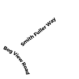
Single Family Residential owned by SPENCER DANA L & AMY - 15 BOG VIEW RD
Single Family Residential owned by GRASER WILLIAM M & ALICIA L - 11 BOG VIEW RD
Single Family Residential owned by DAVIS, MATTHEW G & ANDREA M - 69 CRIMSON HARVEST DR
Single Family Residential owned by CHEVERIE JOHN & HADLEY